


On a clear, late summer morning, I solo-paddle my canoe into a rising wind, the breeze welcome on my face and arms as the day quickly warms under bright sun. I am on remote Spencer Lake, north of the Bigelow Range, in the vast roadless (at least paved road, roadless) territory northeast of Eustis and southwest of Jackman. On this pristine water for the first time, I am joined by three paddling companions, for a two-night, three-day outing. One works his kayak a ahead of me and off to my right; the two others share a canoe and paddle a hundred feet or so off my left shoulder. There is not another watercraft in sight, no sound but those of the slip into the bright blue water of my spruce paddle, and the sweet slap of waves that meet the bow, divide, run behind me and up the lake.
We launched in late morning of the previous day on the comparatively shallow northern extension of the lake, known as Fish Pond. Here, a family of mergansers work lily-pad covered coves for fish and aquatic insects. Leaving them to their hunt for food, we paddle to open water in the middle of the pond, watching the shoreline for moose – or whatever else we might discover. A great blue heron takes off from the shallows, wings its way out of sight down the lake, a lanky form that assumes gracefulness in full flight. Otherwise, the view is of sky the color of a blue flame, the deeper blue of the lake water itself, and the mixed dark and light greens of the mixed, softwood-hardwood forest shoreline running southward as far as my eyes can see.
No, no moose, at least not here, not now. Just one week earlier I was surprised to come upon a bull moose high on East Kennebago Mountain. This impressive fellow was grazing a small clearing only a few feet from the summit of West Peak. The elevation there is more than 3,600 feet! Now on remote water, in shallows that seems apt for moose to be feeding, nary a one. Ah, to know the mind of a Maine moose!
As we paddle south to reach the main body of Spencer Lake, we pass out of Fish Pond through a short and narrow thoroughfare, expecting the necessity to get out of our boats and pull them through low water. Recent rains have kept the lake level high, however, and we paddle through without difficulty. Spencer Lake stretches out ahead of us now in its fullest, with a north to south lie, eight miles long, only a half-mile wide, resting in a sharp and deep glacier-carved valley. This is a deep lake, 40-80 feet deep along much of its center, and 135’ deep near its southern end.
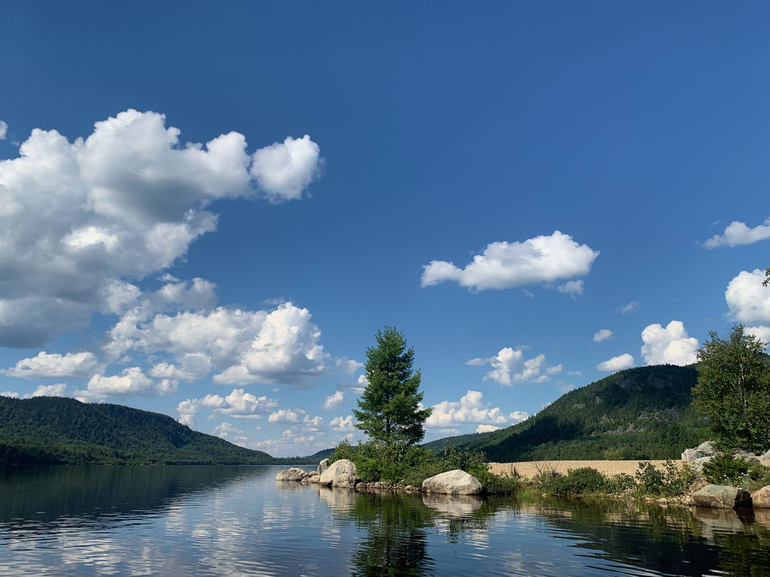
Thickly wooded high ground rises above the valley on either side: Hardwood, Spencer, and Bear Mountains to the west; Hardscrabble, Hedgehog, and Heald Mountains to the east. The growth along their slopes is a mix of maples, white birch, cedar, balsam fir, spruce, and white pine. The effect when surrounded by such topography is that of being in a world apart. As for the water, I paddle for those first few hours at least, in flat calm, with hardly a ripple, unusual on this wind channel of a lake. Such a day!
We pass Hardscrabble Lodge, tucked in a cove on the east shore, once a sporting camp, now a private residence. The owners maintain two campsites on the lake which the public may reserve and, in the process, obtain the required campfire permit. Such is the only form of camping permitted in the area. (Do an Internet search for Hardscrabble Lodge for camping information.) The lodge and a second residence, much farther down the lake, and located nearly hidden by tree growth are the only developed properties on these remote waters, and quite unobtrusive.
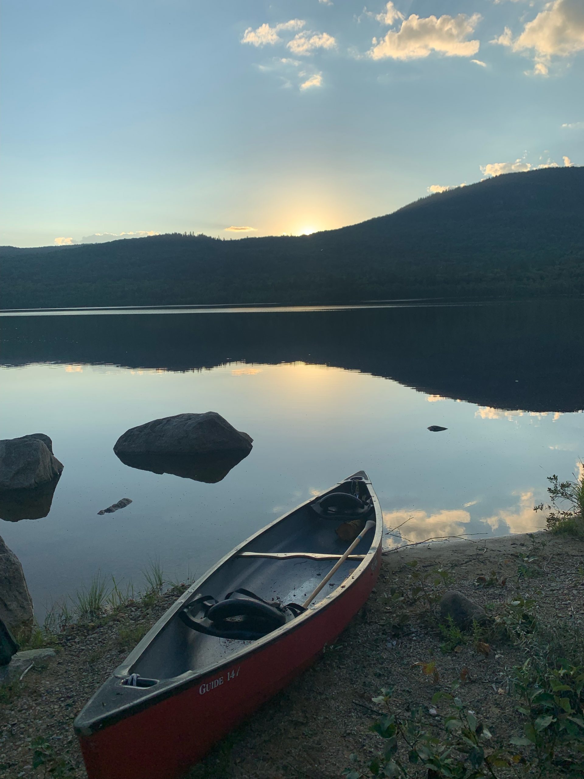
Our campsite is half-way down the lake, well out of sight of the lodge, in another cove that offers what for me amounts to luxury accommodations – a sandy beach, easy for landing our boats and perfect for a swim, a picnic table, and a privy. We are greeted there by another gathering of mergansers who paddle into our cove. Perhaps they are curious at who is showing up in this otherwise quiet neighborhood. That curiosity apparently satisfied, the birds paddle away, cruise up the shoreline, round a rocky point of the tip of the cove, and disappear from view. A pair of loons appear, well offshore, yodel back and forth, sail off, continuing their exchange from time to time well after darkness falls. Aside from the campsite caretaker who stops by to confirm that we have a reservation and campfire permit, mergansers and loons are our only visitors.
Why choose Spencer Lake for our trip? The lake is on the route of the Northern Forest Canoe Trail, (NFCT) which travels some of the most striking lake, pond, river, and stream waters in Eastern North America. The Trail starts in the Adirondacks, at Old Forge, New York, continues through Vermont, Quebec, and New Hampshire, before entering Maine on the way to the northeastern end of the trail on the St. John River at Ft. Kent – 742 miles later. I, and others in our small party, have paddled portions of the route in Maine, on waters familiar to many Mainers – the Rangeley Lakes Chain, Flagstaff Lake, Moose River, Moosehead Lake, the Allagash, for example – and are curious about sections new to us.
So it is that we planned this 3-day outing, to paddle the full length of Spencer Lake and return, a distance of 20 miles when factoring in all of our meanderings. Here I welcome the opportunity to explore the rugged shoreline, walk on a portion of the portage trails that await long-distance voyageurs, and fill in a blank in NFCT history – to go where I have never gone before.
Our starting point is a basic (Some maps use the term “primitive “) boat launch on the north end of Fish Pond, which is continuous with Spencer Lake since construction of a dam decades ago at the southern end of the lake. That dam controls flowage down Little Spencer and Spencer Streams into the Dead River and the Kennebec. There is no boat dock or ramp at Fish Pond– simply a grass and gravel shore that slopes into the water. As I note above, there is a campsite adjacent to the launch, managed by Hardscrabble Lodge.
To reach the Fish Pond launch point, which is in Hobbstown Township, we drive over 14 .5 miles of woods roads, west of Parlin Pond, off Maine Highway 201, north of Bingham and Caratunk, south of Jackman. (See Maine Atlas and Gazetteer map 39-C.) In the process we pass the site of a World War II prisoner of war camp, where German prisoners were held a supplemented the local logging labor force. The site is marked by a sign. There are no buildings remaining, but there is a memorial established by students at Jackman’s Forest Hills High School, and the remains of a brick oven reportedly used by the Germans to bake a favored brown bread they had been accustomed to back home.
The area is in the vast forest of northwestern Somerset County, east of the far northern townships of Franklin County, such as Kibby and Skinner, and south of the Moose River. Peaks such as Number Five Mountain and Coburn Mountain draw hikers. A scattering of pristine lakes, ponds, and streams attract those who like to fish – or simply paddle. It is possible to reach Spencer Pond from Franklin County, by the Spencer Road east of Maine Highway 27, but the eastern approach from Highway 201 offers better road, and access to services. Do note that all roads in this area, once off the highway, are graveled roads, privately – and often only occasionally – maintained.
Back on the lake, I continue my day two paddle over waters that have stirred considerably since I took an early morning dip in the calm waters of our campsite cove just before dawn. I feather my paddle between each stroke to lessen wind resistance. My canoe is 15’ long, with weight of my gear distributed to make the bow lighter than the stern. Trimmed this way, the canoe rides up through the waves rather than plunge down into them, and is responsive to my steering as I paddle from the stern seat. I angle the bow slightly, rather than paddle head-on into the oncoming wind-driven waves to dissipate the force of waves, and avoid the inefficiency of bouncing over them. Of course, I am wearing a PFD (life-jacket), in the event that a gust flips my canoe over. I have adjusted the straps on the PFD for a snug fit, in order that it not float up and block my vision should I tumble into the water. In the pockets I carry a boat whistle, and, for good measure, a small boat horn which has a sound reaching a farther distance than a whistle – significant in high wind conditions when sound can be muffled.
Water, water everywhere – well, not everywhere, for there are those surrounding hills, and the low peak of Heald mountain to my left (east) with a jagged cliff just below its wooded summit. A bald eagle, white tail bright in the light of the high sun, flies overhead, circles above our paddling party, soars off. The loons pop up, a few hundred feet off, dive, and paddle away as small dark specks, until they disappear from view altogether. Dip and swing, dip and swing; bright blue water; overhead a mix of building cumulus clouds and blue sky; my canoe and I, and an immense quiet – all this makes for quite a time.
As we near the southern extreme of the lake, and the outlet to Little Spencer Stream, the land mass offers shelter from the wind, and we enter smoother waters. A new sound arises – the low roar of water passing over the dam, which is out of sight, a hundred yards or more downstream. We search for the portage trail, to the left of the outlet, river left in canoe lingo. A NFCT marker on a tree guides us to the take-out point, which is essentially otherwise indistinguishable from the surrounding shoreline – rocks, cedar and fir, a few red maples, marsh grass. No beach, no dock. We tie our watercraft securely to adjacent trees, make a way up a short rise through high grass and brush, reach an old, grassy woods road, showing no sign of recent use.
The portage trail winds through the woods on this old roadway, proceeds up and over a natural berm that defines the south end of the lake, and drops down to the waters of Little Spencer Stream. The stream emerges from the dam, which we can barely see through the woods between the trail and the lake. On this day the outflow fills the stream bed, bank to bank, in high water conditions.
We do not plan to paddle down the stream, which continues for 7 miles, joining (big) Spencer Stream in the process, to empty into the Dead River below Grand Falls. These waters flow next into the Kennebec by the Somerset County community of The Forks, and roll downstream to enter the Gulf of Maine by Popham Beach. Because most NFCT paddlers move from west to east, they reach Spencer Pond by traveling upstream from the Dead River below Grand Falls, for those 7 miles. Poling, wading and dragging, and occasionally paddling as conditions permit, make this possible. Such is hard work, to be sure. This is how voyageurs have traveled for centuries when the way forward is upstream. I am mindful of those who have passed this way before; indeed, also of the loggers and river drivers who worked this territory, muscling wood into the flowage to run far downstream to mills along the Kennebec River, to feed the world’s need for wood products of many kinds.
We head back along the portage trail, launch our boats, head up lake towards camp.
Now we have a following wind to make the return trip in good time. My canoe moves long swiftly even when I ship my paddle, so steady is that wind. But it is fun to paddle hard enough to ride the waves, and I do a bit of that, too. Back at our sandy cove campsite, it is time for a swim, and preparations for supper. We share in the cooking on this trip. Tonight’s menu includes fresh veggies for hors oeuvres and chicken stew. My contribution to the evening meal is dessert – a blueberry cobbler, made from scratch, baked in a camping oven. I have quite an appetite after a day of vigorous paddling!
That evening, around the fire we tell tales of paddling trips past – on the Allagash, the St. John, the Moose River, and more distant locales such as Alaska and the Everglades; of what we know of Native paddling routes in Western Maine; of the constellations in the night sky above. Such is canoe camping at its best – a good day’s effort on the water, a restoring meal, followed by a camp fire and good conversation. Before slipping into my tent, I walk the sandy beach by starlight, watching for a shooting star. There goes one!
Time for bed.
The following morning, our third day, we paddle northward, to return to the Fish Pond launch site. But before we haul out to load our watercraft on our vehicles, I take an extra turn around the pond, as we all do. I paddle and poke among the lily pads, find purple water hyacinth still in bloom, come upon a few of the local mergansers again, surprise a frog or two, spy a turtle, savor the quiet.
There is still good paddling weather remaining! Find an intriguing water to explore. Savor this quiet time of year on the waters of Western Maine. We have here a place apart!
Text and photos copyright Douglas Allan Dunlap 2022
