


Man is born to die. His works are short-lived. Buildings crumble, monuments decay, and wealth vanishes, but Katahdin in all its glory forever shall remain the mountain of the people of Maine. – Former Governor Percival Baxter
The Mountain of the People of Maine
Many a Mainer aspires to stand on Baxter Peak, elevation 5268’, highest point on Katahdin, the striking mountain mass that rises well above dozens of nearby rugged peaks, the vast neighboring territory of Northern Forest, and a vast territory remote lakes and ponds, rivers and streams. Katahdin stands at the heart of Baxter State Park, nearly 210,000 acres in size, a park gifted to the people of Maine through land acquisitions and subsequent donations, beginning in the 1930’s, made by former Governor Percival Baxter.
The gift came with essential provisions – one of which was that the land within the park be managed at a standard of forever wild, that conditions be maintained to sustain wildlife, and that people would be able to experience such a pristine setting in perpetuity. For these reasons, a majority of Park land has the status of wildlife refuge, no pets are permitted, roads are of gravel, and camping and cabin facilities are basic – no electricity, no running water (water is from natural sources and users are advised to purify the water before using), no indoor plumbing or showers, no gas stations or stores.

That said, the forever wild conditions of Baxter Park offer for me some of the most satisfying and awe-filled moments in the half-century or more I have spent in the outdoors. Nearly 100 years ago, Percival Baxter was concerned that growing industrialization and urbanization would obliterate wild areas in Maine and elsewhere across the country. Baxter himself spent much of his childhood in the area of Oquossoc and Rangeley, in Northern Franklin County, and valued highly the impact on him, at an early age, of cherished time in wild settings.
Come along with me on a Katahdin hike, my most recent of a few dozen over the years, an ascent on the newly reconstructed Abol Trail.
On the Summit
On a blustery July day, I stand at the summit cairn on Katahdin, at 5268’ elevation, Maine’s highest mountain, buffeted by powerful swirling winds that test my balance – even though I am for the moment on relatively level ground, feet planted on solid rock. To the east the summit terrain falls away dramatically into the steep, boulder-strewn glacial cirque of the Great Basin, where a shaft of sunlight shoots through the clouds to brighten the sharp blue of Chimney Pond, nearly 2000’ below – straight down. To the north and west, cloud after cloud – in multiple shades and shapes of gray – rises and falls over the rough-rocked Tableland, reducing views to a matter of a few feet. Suddenly, the cloud cover breaks apart! The wind whips shreds of gray into what is literally into thin air. The sun breaks through. Moments later, moment later, in a roar, the wind bores in, clouds build, and the summit, as the saying goes, socked in. The cycle repeats. Henry David Thoreau called Katahdin a cloud factory, with good reason.
Katahdin, as mountains do, and this great mountain notoriously does, is making its own weather. Forecast for the valley below is for a mostly sunny day, and I will descend into that sunshine before this day is over. From my summit vantage point, at moments I have a look beneath the high elevation clouds, towards the lake country where lie Rainbow Lake, the Debsconeag Lakes, Jo-Mary Lake and countless other waters. I recall many a good day hiking along those waters, enjoying some good fishing, and setting up my backpack campsite for an overnight stay.
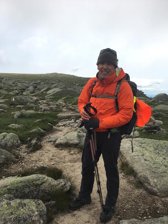
Wild wind, chilly temperatures borne on that wind, clouds swirling – I am having the time of my life. This is Katahdin, and I love it. For Katahdin hikes, and most all high elevation treks, I am dressed in wicking layers, and wear a wool cap, neck warmer, and gloves suitable for Nordic skiing. My outer layer is a wind and waterproof shell, and in the pack I have rain pants of similar material. Bagel sandwiches, apples, Maine cheddar cheese, home-baked sweet potato-oatmeal-coconut power bars, and a liter and a half of water, serve as my fuel.
Abol Trail, Old and New

I have reached the summit, Baxter Peak, by the Abol Trail, an historic route from the southwest. It may be said that one of Katahdin’s oldest approach routes is also its newest, as this trail from Abol Campground on the park perimeter road, has been rebuilt significantly within the past decade. Historically, the major portion of the Abol Trail has been on a rock slide that rumbled down the face of the mountain in 1816, opening a great, steep, scar more than one mile long, through otherwise formidably thick fir and spruce. Slides require vigilance for hikers to negotiate, but can serve as a quicker way to move up than fighting through undergrowth. So steep was the slide, however, that those who preferred its direct route to the summit were advised to descend by different route, as the rock and gravel was prone to shift as hikers plant their fee, step by step, on the way down.
Two centuries later, in 2013, the slide, by nature unstable, moved again, obliterating much of the long-established blue-blazed route. Park authorities closed the trail and explored alternative routes that might retain the trailhead at its base, and also retain the point where the trail meets the tableland before that final stretch to the Katahdin summit. Trail crews cut a switchback through boreal conifers and white birch to the west of the most unstable stretch of the slide, and constructed rock staircases in steep sections to reduce trail-wearing erosion. They routed the new trail to dramatic overlooks previously never seen by most hikers. In the process they achieved a new standard in trail building – still challenging enough, but durable; protective of the terrain; downright inspiring for the views offered.
After spending the night at Abol Campground I rise at 5 a.m., my daypack ready from the night before, enjoy a good breakfast of oatmeal and a bagel, and head for the trail. First stop is the Ranger Station, where I sign the Hiker Register, by headlamp. The time is now 5:45 a.m. I am the second hiker to register this day. As I head back through the campground to the point where the footpath heads up the mountain, there is just enough pre-dawn light to see my way. I switch off the lamp to save battery power. I am under way!
The route follows a well-worn blue-blazed path to a stream which it follows for a bit more than 0.5 miles. The trail swings northeast, which gives me pause. I know that there is a westward switchback coming up, but this point is too soon for that. Following the blazes – when in doubt I follow the blazes – I gain ascent, and near the base of the original Abol Slide. Here the evidence of the slide is in the form of scree, but forest growth predominates. At a point where I gain a broadened look at the slide and its line up the steep mountainside, the new, switchback section of the trail veers to the left (west), clearly marked with blue blazes.
Up I go, angling now, rather than straight up, which was the direction on the former slide route. The rock staircases, common in the high country of the American West – the Sierras and the Pacific Crest – are becoming increasing common in the rugged country of Northern New England. The rockwork takes longer to build than clearing trees and brush alone, but holds promise of lasting for many years – thereby saving trail maintenance time and expense. The long westward cant ends with a glimpse along the southwest wall of the mountain, in the direction of the Hunt Spur and the mountains beyond: The Owl, Mt. OJI, and the more distant Brothers Range.
The switchback turns, and slabs east, rising to a striking viewpoint about 0.1 mile before the junction with the upper 600’ of the traditional Abol Slide route. A series of flat-topped boulders mark the viewpoint, just right for sitting for an Oh my! view over the southwest section of the park – Daicey Pond, Sentinel Mountain, and beyond, over the lake country, towards Whiteface and the Gulf Hagas Mountains. I linger here for a while, taking a water break, letting my eyes roll over that broad and long view. The forest growth makes a transition in this area, from trees to krumholtz: twisted, low-growing back spruce, occasional gnarled balsam fir, and similarly stunted white birch – at this elevation, of an amber hue.
Beyond is the slide. Here I go into scramble mode – using hands and feet, to make my way up and over the rock slabs, boulders, and scree of the uppermost section. No haste here. I am careful to focus on each foot plant, assuring that I have a secure push-off point before heading upwards. My trekking poles help with push-off at some junctures. In other spots I remove the poles from my wrists and place them above me, before hauling myself up the next pitch.
The Abol Trail ends at the Tableland, where it meets the Hunt Trail at Thoreau Spring (sign), elevation 4664’. The spring is not reliable, and even when there is water, it may be quite shallow and difficult to access without a water filter and pump. I do not depend upon it. Henry David Thoreau attempted to reach the Katahdin summit from the Abol side of the mountain in 1846, but apparently, upon reaching the tableland and the site of the spring, he observed the higher ground to be so cloud-wrapped, and winds so formidable, that he did not continue farther. Still, to reach an elevation less than 600’ from the summit height, making trail where there was no marked route, and having to bushwhack miles from his party’s camp near the West Branch of the Penobscot River, was a mountaineering feat in itself. What he surely also accomplished was to record his awe at the wild forces of nature he encountered, and proclaim that awe to the world.

Hunt Trail from Abol Trail to Summit
The Hunt Trail originates at Katahdin Stream Campground, and is the route of the Appalachian Trail. To reach the summit of Katahdin, at the junction of the Abol Trail with the Hunt Trail, I turn right on the Hunt Trail, and ascend over rocky terrain for another 0.8 mile. The route is marked by cairns and blue blazes, and is edged by lines of stones placed to keep hikers on the trail to prevent foot damage to fragile alpine plants. Such plants are remarkable affirmations of life, growing as they do in such a harsh environment. Once damaged, plants such as diapensia may take decades to recover. (Stay on the trail, please!)
Abol Trail Details
The Abol Trail offers the shortest route to the summit of all Katahdin trails. Distance from the Abol Campground trailhead to Thoreau Spring is 3.4 miles; with an additional 1.0 miles to Baxter Peak – a total of 4.4 miles one-way. That amounts to an 8.8-mile round-trip.
When I am hiking Katahdin I allow one hour per mile, including breaks, times to linger at viewpoints or to inspect alpine plants, and time on top. As indicated, I start at first light. If weather or other circumstance impedes progress, I want to have the maximum amount of daylight available to me. I always carry a headlamp, even on day hikes. Most definitely, I want to avoid hiking down the mountain in darkness.
Baxter Park authorities require that each person in a hiking party carry a flashlight. Because a hand-held light is impractical on a steep mountain trail, my light is in the form of a headlamp. I also pack a spare headlamp, and spare batteries for both.
Camping, Parking – Reservations a Must
To achieve an early start I seek to camp the night before, usually at Abol or Katahdin Stream Campgrounds when my plan is to hike the Abol Trail. Those who plan to enter the Park on the same day as a Katahdin hike are advised to obtain a parking reservation ahead of time. Once the limited numbers of parking spots are filled, no more vehicles are allowed into the Park. Even with a reservation, day-trippers can expect to encounter a line of cars waiting for the Togue Pond Gate to open at 6:00 a.m. Each vehicle most be processed. Because of the associated wait time, day hikers may not reach a trailhead until 7:00 a.m. or later. By that hour, I may be two miles up the trail.
These and other details are available on the baxterstatepark.org website. I recommend that everyone who wishes to visit the park check this website, and call the Park (207-723-5140) for further information or with questions. I have always found Park reservations staff to be extraordinarily helpful. Often they can suggest alternatives that help a party to have the hiking experience they seek, even if the first choice for camping or hiking trail is not available.
Getting Ready
Katahdin is one the most storied mountains in North America. Hikers travel to Maine from all over the world to reach its wild summit. We in Maine are fortunate to have it so near – as the mountain of the people of Maine.
To prepare for a hike of Katahdin’s magnitude, those of us who live in Franklin County have the benefit of 10 nearby peaks over 4000’ elevation, from Saddleback in the northwest, to the Bigelow Range high peaks in adjacent Somerset County, to the northeast. Practice here!
I hope to see you on trail – in our Western Mountains of Maine, or on the heights of Katahdin!
