


Is this the summer for you to start, or renew, a family or friend hiking tradition? More and more people, locals and visitors, are discovering the benefits of time spent on foot in the woods and mountains of Maine: pristine beauty of the Northern Forest, long views extending from Canada to the sea; clear running brooks; coming face to face with a Gray Jay, a pink Lady Slipper; finding the track of a deer, raccoon, or fox; and, of course, sighting a moose.
I am on the watch for hikes of moderate length and order of difficulty, for those new to hiking in our Western Mountains of Maine. One hike that I return to each summer, and each winter, is Rumford Whitecap, a 2214’ elevation open summit which lies west of Franklin County near Andover, but offers unique views of many well-known Franklin County peaks – Mt. Blue, Bald Mountain, the Tumbledown-Jackson Range, and the Saddleback Range. Its 5.0-mile round-trip (depending upon choice of trail) leads to broad ledge on the high ground, offers views toward Mt. Washington in New Hampshire, and the valley of the Androscoggin and Ellis Rivers, and the range of mountains between the Baldpates and Bemis Mountain south of Rangeley. The Mahoosuc Land Trust manages the 751-acre Whitecap Preserve.

There are a number of mountains in Maine named “Whitecap”, among them a trail-less peak in remote northwestern Franklin County, near the Quebec border, which I have climbed. Others include Sunday River Whitecap near Grafton Notch with a striking view of the Notch and Old Speck Mountain; and Whitecap on the Appalachian Trail north of Gulf Hagas in the so-called One Hundred Mile Wilderness.
While these others are challenging for the ruggedness of the terrain or distances required to reach and ascend them, the Rumford Whitecap trails require a minimum of upward scrambling or long reaches, and the trailhead is within a one-hour drive of most Western Maine communities.
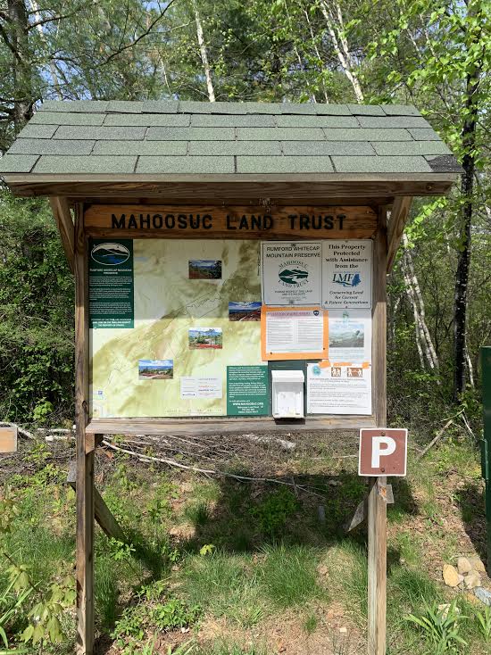
On a day when spring is hastening towards summer, I drive in early morning to the trailhead on the East Andover Road, in North Rumford. (Maine Atlas map # 18, E-4). The simplest directions are to travel on Route 2 to Maine Highway 5 heading to Andover. Travel 2.8 miles north; turn east to cross the Ellis River; turn left (north) on the East Andover Road. In 0.2 miles reach the trailhead parking area and trail kiosk on the left. Park leaving ample space for other vehicles. This is a popular hike. The lot may fill by mid-morning.
Two routes lead up the mountain, gaining nearly 1700’ of elevation in the process. The Red/Orange trail is 2.5 miles one way, starting from a red gate across the road from the parking area. The Yellow Trail begins 0.3 miles north on the road. Distance to the summit from the road is 2.9 miles. During the pandemic, hikers were encouraged to ascend by the Yellow Trail and descend by the Red/Orange Trail. Over the years I have hiked both routes, which join 0.6 miles before the summit. The Yellow Trail is steeper in its upper section, and longer, with the extra length through fairly thick woods; but offers fine views to the north and west in its upper ledges. The more direct Red/Orange Trail passes through more diversified forest before joining the Yellow Trail. Of the two I prefer Red/Orange round-tip, or ascent by Red/Orange and descent by the Yellow Route.

I choose the Red Trail for my recent hike, pass the aforementioned gate, and walk 0.1 mile to a clearing where a north-south snowmobile trail crosses and a Hiker Register stands on the far side. After signing in, I head left, looking for the red or orange diamond symbol that marks the trail. In some places a paint blaze serves as marker. At the immediate edge of the clearing the snowmobile route veers left and crosses a brook over a planked bridge. Although there is a red symbol by this snowmobile bridge, this is NOT the hiking trail. My route angles to the right, to begin a steady ascent, brook on the left, a stand of hemlock on the right.
The song (zee-zee zee-zoo-zee) of a black-throated green warbler, a frequenter of hemlocks, breaks the silence. As I am alone and make no sound, and am the first person on trail, this warbler and the other birds of the forest sing out, unperturbed. Often I am asked by hikers why they do not see wildlife or hear birds. A common reason is that creatures of the world are well attuned to sound, and that of the human voice prompts them to hold silence, or depart, for their protection. Hold silence in the woods, or better yet, sit still for a time, and creatures of the woods may make their presence known.
The well-marked trail follows the remains of an old woods road, barely recognizable as such in some sections, but straightforward to follow. Run-off streams tumble down the slopes to the right of the trail. I surprise a woodchuck, which moves quickly along the trail for a fellow as ungainly looking as it is, darts into tall brush, and disappears from sight. A brown snake is my next sighting. It is as though I am the first visitor of the day to a zoo, and the creatures are going about their morning routines – but of course this is not a zoo. It is the real home of mammals and birds, reptiles and birds, of the Maine woods. I am a visitor.
Two trails depart left in the first mile to join the Yellow Trail, which is well out of sight, a quarter mile or so to the north. Lower of the two is the “Connector”; the other, which I reach 20 minutes later, is the “Boundary Trail”. These offer alternate routes to the lower end of the Yellow Trail. Discoveries! Tiny bluets grow in batches along the trail. More color: purple violets; painted trillium – distinctive white with a splash of purple and red at the center; bunchberry, four creamy-white flowers in this season, later to produce four bright scarlet berries.
A half hour on trail brings me to a re-routed section recently constructed to deter erosion. The new route is well marked, and includes a six-foot planked bridge over a draw, and passage through an extensive stand of beech, with their far-reaching horizontal branches. The trail rejoins the original route, passes a jumble of glacial erratic boulders, ascends a series of rock steps, and enters a transition zone where conifers dominate the higher terrain. In one hour I encounter the first section of ledge, plunge back into woods, out again to ledge, and come to the intersection with the Black and White Trail (sign). This which leads eastward 3.3 miles to the summit of Black Mountain and 4.7 miles to the Black Mountain Ski Area by the Isthmus Road in Rumford. The Black and White Trail can be difficult to follow in sections. Hikers considering it should obtain detailed directions for its route.
On to the summit of Whitecap! I bear left at this trail junction and reach more sections of the light grey ledge that characterize the upper parts of the mountain, and give the mountain its name. Blueberry bushes appear. I make a mental note to return in July for one of Maine’s most precious treats – wild blueberries at the source. As a boy I would go berrying with my family near Mt. Monadnock in New Hampshire. I never had much to contribute to the family haul, as I ate most of what I picked. The joys of childhood in the country!
At 1.9 miles I reach the junction with the Yellow Trail, which comes in from the left (north). The Red/Orange Trail becomes the sole route for the remaining 0.6 miles to the top. The trail makes a turn to the east, and then a bit south, descending over a short stretch – counter-intuitive, but the correct route – before resuming its upward trend. Fir, spruce, and pine become less frequent, though they still grow, here and there, out of cracks in the ledge – a remarkable sight, a demonstration of the sheer persistence of life. As ledge predominates, I am reminded that in winter, there are skiers who pack their skis to the top and ski over what is then a nearly unbroken field of wind-packed snow cover.
The horizon of the summit ledge meets a sky of bright blue punctuated by great bundles of cumulus clouds – an uncanny sense of being at the edge of the world, where the earth meets the sky. Advancing, I see the small summit cairn, rather small against the surrounding ledge and open sky. I am hard pressed to think of another Maine summit as open as this one as, at any elevation. Little Jackson comes to mind, as does Bald Mountain near Weld. Saddleback, of course, has broad sections of glacier-raked ledge, but the heights of Whitecap are distinctive. Come and see! (The closest resemblance is to Mt. Cardigan in New Hampshire, with a broad swath of high ledge, but that mountain has a fire tower rising from its summit. Whitecap has no such structures.)
A strong wind powers in out of the northwest – a frequent flyer on clear, sunny days.
It is strong enough that I feel chilled. Mountains make their own weather! I step away to leeward, don a warm layer, and sit at a perch with a view below of the valley of the Ellis River, with its scattered farmsteads; the broader Androscoggin River Valley; and the distant, but distinct Presidential Range in New Hampshire. Quite the sight! Among the hills that rise to the south of the Androscoggin stands Mt. Zircon, a former fire watch peak with its own rocky top. I make a note to explore its heights, and do so in the week to follow – for a look back at Whitecap.

Following a restorative lunch of a bagel and sharp cheddar cheese, and a Maine- grown Macintosh apple, I circle the summit, first to look towards Bald Mountain and Saddleback Wind Mountain from this, the Carthage side; then the Tumbledown-Jackson Range. From this angle Tumbledown Mountain itself, which plays second fiddle in hiker interest to high elevation Tumbledown Pond, appears particularly prominent.
The Saddleback Range rides the northeast skyline, Saddleback Horn the farthest distinct feature I can see in that direction. Immediately to the north, across and above Roxbury Pond, lie a particularly rugged section of mountains where Oxford and Franklin County meet, east of Black Brook Notch: Old Blue, Elephant, Bemis. Come and see, indeed.
A lie-back to watch the clouds: High winds whisk the massive white puffs across the sky, their shapes changing – a reminder of childhood hikes. Time to go. On the way down I opt to stay on the Red/Orange Trail, saving the Yellow Trail for another day – perhaps for my anticipated return to gather wild blueberries.
On the descent I meet a party of two on the Red/Orange Trail; and at the parking lot, one other party of two who head for the Yellow Trail. This is a mid-week day. At high summer, expect many more people on trail, making early starts advisable. Many thanks to the Mahoosuc Land Trust for their stewardship of this trail system. Do come here to find a quiet overlook, to see for miles, behold trees growing amongst the summit rocks, watch clouds race by.
Tips for Introducing Young Children to Hiking
Some advanced planning can increase the likelihood that a child will enjoy a hike and want to go again.
• Be on-trail early: An early start offers hiking time during a relatively cool part of the day, and increases chances of seeing wildlife. In summer, by mid-morning, much wildlife has sought cover.
When preparing our children for a hike, we would pack daypacks the evening before. All that was needed in the morning was to put the lunch and snack foods in the packs, and head out.
Purchase or print out a map. Show children the route on the map. Kids enjoy knowing where they are headed. Map reading skills are a gift to our children!
• Water: Bring sufficient water for the hike up and the hike down, stopping to drink once per hour, whether anyone feels thirsty or not. Delaying can cause the onset of dehydration. On a 5-mile hike such as Whitecap, I bring one 750 ml water bottle for the hike up, and one for the hike down. I may not need all of this, but I have it in case I do.
I fill my own water bottles at home, to keep disposable plastic bottles and cans out of the mountains. When I see a bottle or can lying in the woods, I pick it up, and carry it out. Kids know the importance of doing this.
• Food: Fruit, simple sandwiches such as PB&J; homemade, healthful trail bars.
Recipes for such bars are widely available. Involve kids in baking them – much fun. You will have healthy snacks at a fraction of the store-bought price, and keep wrappers out of the woods.
• What to wear: Footwear with good grip; hat for sun protection; wicking clothing for socks, shirts, and pants/shorts, to avoid accumulation of perspiration – which cools rapidly in windy conditions; warm and wind-blocking layers for cool conditions. I have met parties who can’t remain on a mountain top for the view because their clothes are soaked with sweat and the wind brings on a sharp chill.
• Contingency plans: Inform a responsible person in writing of your hiking plans and whom to contact if you do not return as planned. Establish a turn-around-time (TAT) and stick to it. Calculate the number of hours between your start time and end time (no later than sundown). Divide this by half. Example: Time is 8 a.m. You need to be back at your vehicle by 12:00 noon for other plans. TAT is 10 a.m.
• Keep together: Never divide your party between fast and slow hikers; this is discouraging to those who move slowly, and dangerous in the event of a mishap. Treat phones as emergency devices. Take photos if you wish, but please do not speak on a phone or play music within the hearing of others. Carry whistles. if someone becomes separated from the others, a whistle will help in locating the separated person. Pack a first aid kit.
• Destination Choice: My favorite beginner hikes are in themselves, while relatively short and uncomplicated., with intriguing sights along the trail. A few of my favorites: Center Hill Nature Trail, Mt. Blue State Park, Weld; Hopping Frog Nature Trail, Webb Lake Unit, Mt. Blue State Park; Mingo Springs Birding Trail and Cascade Gorge Trail (watch for slippery rocks near waterfalls and chutes), and Hatchery Brook Preserve, Rangeley; Tim Baker Nature Trail, Oquossoc; Maine Huts Trail along east shore, Flagstaff Lake; Cathedral Pines, Eustis.
• See it all through the eyes of a young person: Take your time. Invite children to speak of what they see and hear. I have accompanied teachers on woods walks with children when they stop; invite each child to pick a quiet spot to sit, to watch, to listen; and to sketch or write what they observe. Reach the top? Reach the running water? The goal of all hiking expeditions, from the simplest woods walk, to the most highly technical mountaineering ascent, is the same: to return safely to the starting point. And if you don’t reach the top? If kids have been enjoying the journey, paying attention to their surroundings, they will benefit from the experience. The mountain tops will be there for another day
I hope to see you on trail!
