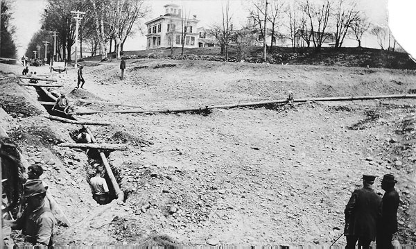
STRONG – Strong’s Historical Society, Public Library, and Elementary School, with the High Peaks Alliance and Maine Historical Society, invite area residents to the Forster Memorial Building for an afternoon of local lore, genealogy, maps, and intriguing images on Sunday, Oct. 9, from 1 p. m. to 3 p. m.
Strong has a rich heritage and history that includes fires, toothpicks, Civil War soldiers, and croquet, and the first registered Maine Guide. Guests will be treated to an old-fashioned ice cream social with all the fixings, along with displays and presentations. The event marks the launch of a project that will include the Civil War Reconstruction years to the early 1900s. When the group has finished their project in May, 2012, they’ll have uploaded dozens of photos, stories, and maps to Maine Memory Network (www.mainememory.net), Maine Historical Society’s online museum. The Society’s treasurer and local history aficionado Carl Stinchfield currently has more than 3,000 scanned photos, documents and glass plate negatives. He hopes some of the gaps in the historical narrative can be resolved through community connections.
“We’re hoping that residents might come forward with old photos or letters or other treasures that we can photograph or scan to upload to our website,” he said.
Many generations of families, including Brackleys, Lamberts, Worthleys, Starbirds, Stubbs, Dyars, Huffs, Allens, Pratts, Luces, Durrells, Richards, Pinkhams, Chandlers, Stinchfields, and Ladds, pre-date the Civil War. Strong was once known as “The Toothpick Capital of the World,” and the Strong Village Cemetery is the final resting place for Fly Rod Crosby, Maine’s first registered Maine Guide. Stinchfield said one part of the project will be “The Bridge That Changed the Map,” documenting the history of residents in a part of Strong which chose to secede and join New Vineyard, rather than spending tax dollars to build a bridge they would never use.
“In fact, Strong has so much great history, we’ll need to narrow topics for our online exhibit,” Stinchfield said.
Teacher Crystal Polk’s students have researched topics, including Google Earth mapping of historic locations in the town, and other team members will share their goals for the project.
The Maine Memory Network has added more than 20,000 historical item contributed by historical organizations, providing viewers with a very distinctive and personalized view of Maine history. The site also offers lesson plans for teachers, examples of student history projects, and online tools for creating and sharing albums. Groups have done online slide shows, told stories, shared their resources and made discoveries. Strong was selected as one of three Maine towns to receive grant funding from a National Leadership Grant from the Institute of Museum and Library Services. For more information, call 684-2195 or 684-3613.


Farmington did this project in 2008, as one of the first 8 teams to join the Maine Memory Network. It was a lot of work, and a lot of fun for the folks on the team. And when it’s finished in May, it can become a thing of pride for the town. Good luck, Strong team. Make your town proud.