


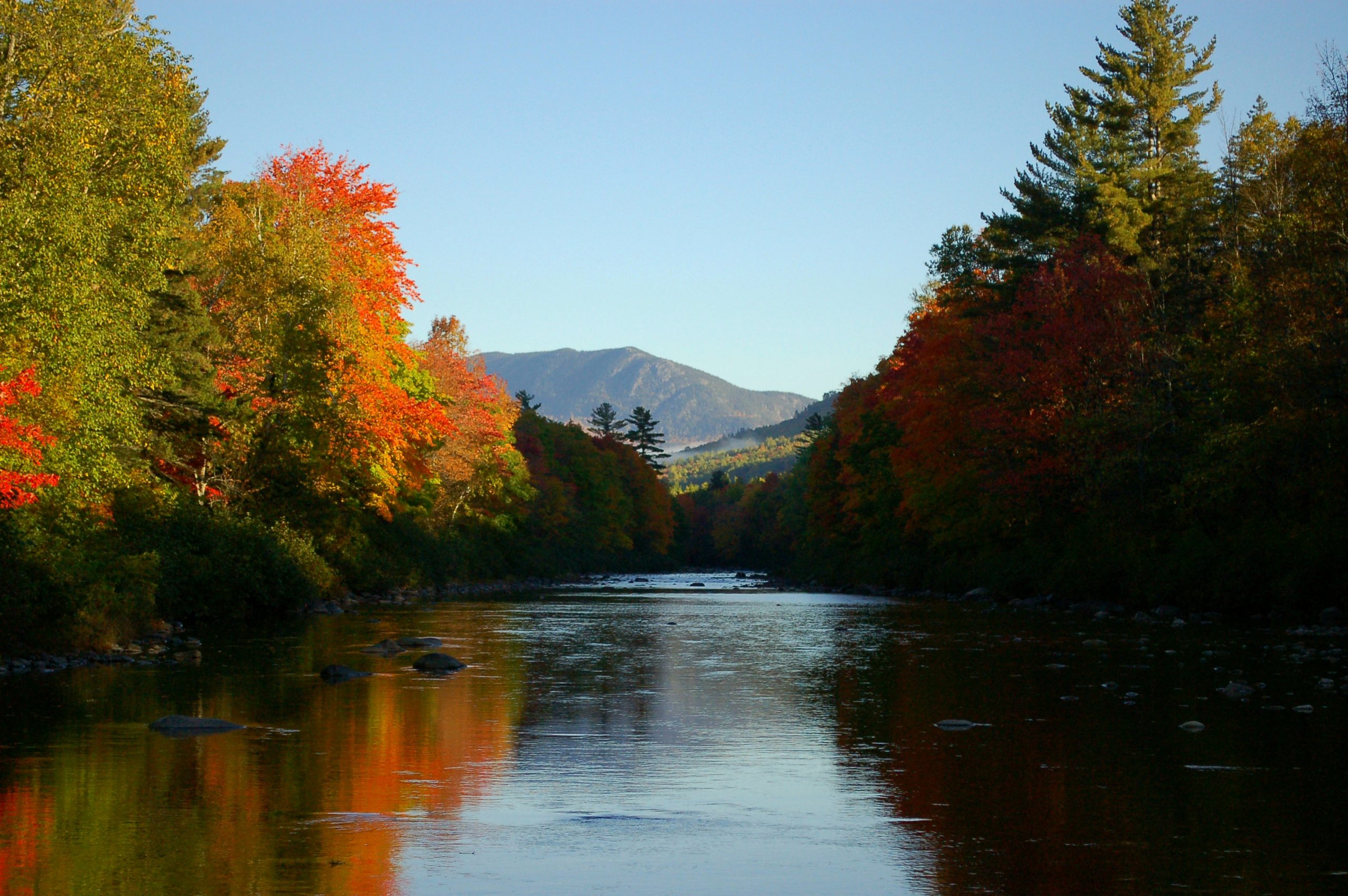
KINGFIELD – Leafy with a chance of color! The foliage forecast from the Maine Department of Agriculture, Conservation, and Agriculture states that northern Franklin County will be seeing peak foliage this week, between Oct. 6 and Oct. 13. The trees are showing a gorgeous range encompassing lingering green, sunny yellow, bright orange, and flaming red. Much of the trees have changed colors, but the leaf drop is still low, maintaining the colors. If you plan to drive north for leaf peeping, there are some overlooks and public access points that provide excellent opportunities to view the colors.
CARRABASSETT RIVER
The Maine DOT rest area in Carrabassett Valley, about seven miles north of Kingfield on Route 27, has picnic tables, bathroom facilities, and river access.
AIRPORT TRAILHEAD
Just past the Sugarloaf Regional Airport on Route 27 in Carrabassett Valley, the Airport Trailhead offers a view of the Bigelow Mountain Range.
CHAIN OF PONDS
First recommended to me by a Maine State Game Warden, the overlook at Chain of Ponds offers a stunning view of the ponds, Indian Stream Mountain, and Bag Pond Mountain. The overlook is maintained by the Maine Department of Transportation and has several informational displays, including information on Benedict Arnold and the Arnold Trail.
From the intersection of Route 16 and Route 27 in Stratton Village, travel north on Route 27 for approximately 21 miles. Right before the overlook, the road passes through a mile-long segment of ledge hill with rugged rock faces on either side of the road. The overlook is on the left. The road is heavily traveled with large trucks, so use caution pulling in and out.

SARAMPUS FALLS
About 15 miles north of Stratton, the Sarampus Falls rest area has a picnic area, bathroom facilities, and a view of Dead River. The falls are only a short walk away. This rest area is on the right heading north towards the Chain of Ponds overlook.
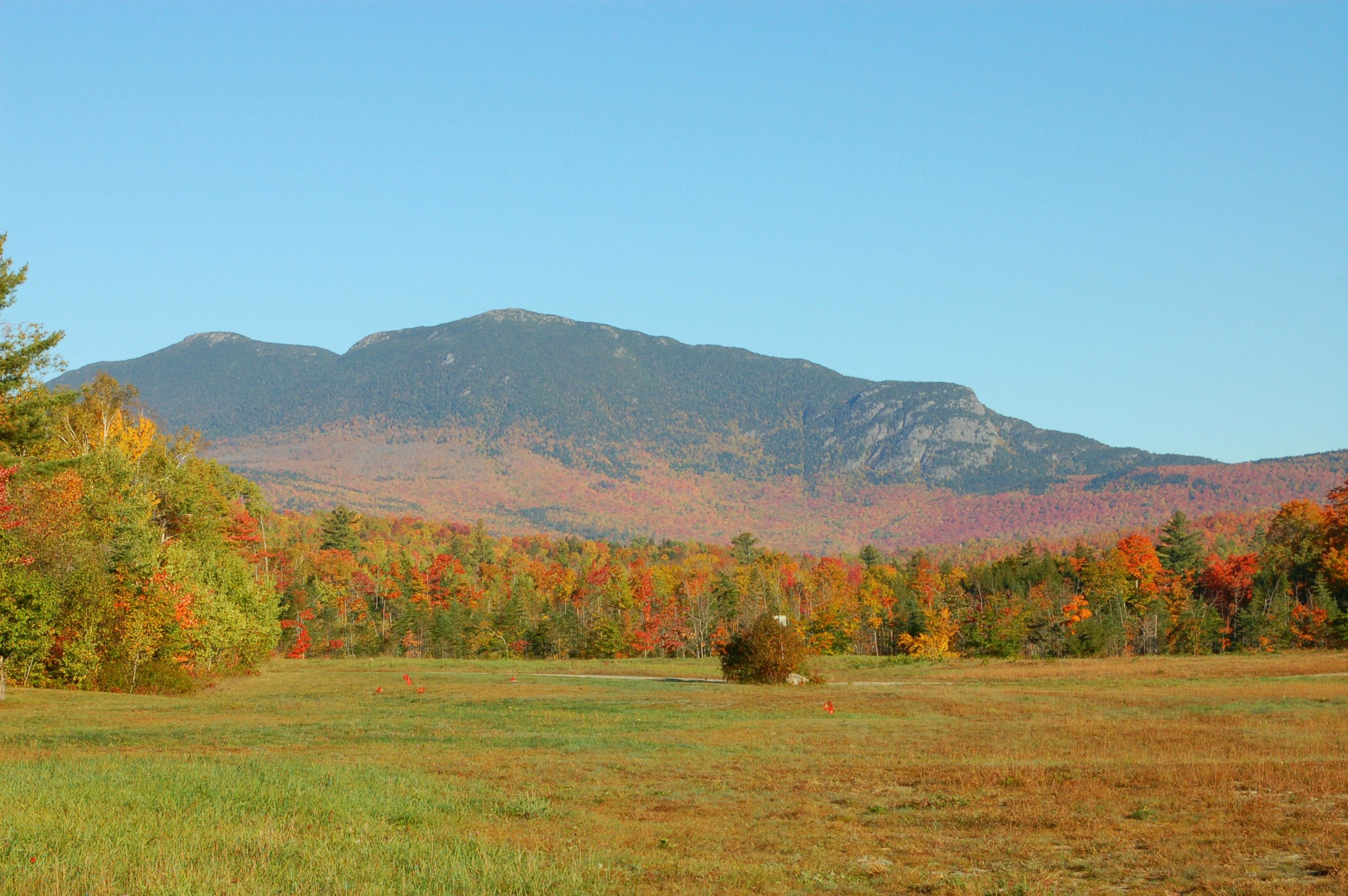
QUILL HILL
On Route 16 between Rangeley and Stratton, Quill Hill boasts a true 360 degree view of the western mountains region. Quill Hill is wheelchair accessible and the overlook is reached by a 12-minute drive up a well-maintained dirt road. At the top, there are picnic tables and a guest log. From the top, you can see the Bigelow Mountain Range, Saddleback, Kibby, Black Nubble, Potato Nubble, East Kennebago, and others farther afield.
The entrance to Quill Hill is located on Route 16 approximately 12 miles west of Stratton or 7.5 miles east of Rangeley.
Quill Hill is privately owned and maintained. There is a suggested donation of $5 per person, with a self-service pay box on the route back down from the overlook.
SMALLS FALLS
The Sandy River flows south-east from Rangeley, and Route 4 follows it closely at times. In Madrid Township, about 12 miles south of downtown Rangeley or 9.5 miles north of center Phillips, the Smalls Falls Rest Area is a popular tourist attraction. There are picnic tables, bathroom facilities, and informational displays. A flight of concrete steps at the north end of the rest area lead down to a wooden bridge with a view of the falls. Crossing the bridge, you can climb up to view the upper sections of the falls. This area has been left in its natural state and children should be closely supervised.
There are a wide variety of other scenic destinations that are particularly beautiful during the peak foliage season. Regardless of whether a site is public or private land, plan to carry in and carry out anything you may need or want. Don’t litter or deface the area, and respect guidelines and rules.
Now, make a plan to get out there and enjoy the color!
